


Brookside City Hall, Jefferson County, Alabama
About
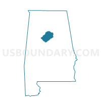
Outline

Summary
| Unique Area Identifier | 522016 |
| Name | Brookside City Hall |
| County | Jefferson County |
| State | Alabama |
| Area (square miles) | 9.82 |
| Land Area (square miles) | 9.81 |
| Water Area (square miles) | 0.01 |
| % of Land Area | 99.89 |
| % of Water Area | 0.11 |
| Latitude of the Internal Point | 33.63826530 |
| Longtitude of the Internal Point | -86.89818040 |
Maps


Graphs
Select a template below for downloading or customizing gragh for Brookside City Hall, Jefferson County, Alabama


Neighbors
Neighoring Voting District (by Name) Neighboring Voting District on the Map
- Adamsville Senior Citizens Building, Jefferson County, AL
- Gardendale Civic Center, Jefferson County, AL
- Hillview Fire Station #1, Jefferson County, AL
- Maurice L West Community Center, Jefferson County, AL
- Mount Olive Elementary School, Jefferson County, AL
Top 10 Neighboring County Subdivision (by Population) Neighboring County Subdivision on the Map
- Birmingham CCD, Jefferson County, AL (455,278)
- Graysville-Adamsville CCD, Jefferson County, AL (10,762)
- Brookside CCD, Jefferson County, AL (4,027)
Top 10 Neighboring Place (by Population) Neighboring Place on the Map
- Birmingham city, AL (212,237)
- Adamsville city, AL (4,522)
- Mount Olive CDP, AL (4,079)
- Graysville city, AL (2,165)
- Brookside town, AL (1,363)
- Cardiff town, AL (55)
Top 10 Neighboring Unified School District (by Population) Neighboring Unified School District on the Map
Top 10 Neighboring State Legislative District Lower Chamber (by Population) Neighboring State Legislative District Lower Chamber on the Map
- State House District 15, AL (48,965)
- State House District 51, AL (48,552)
- State House District 60, AL (36,704)
- State House District 55, AL (35,572)
Top 10 Neighboring State Legislative District Upper Chamber (by Population) Neighboring State Legislative District Upper Chamber on the Map
- State Senate District 17, AL (157,178)
- State Senate District 5, AL (134,976)
- State Senate District 19, AL (109,165)
- State Senate District 20, AL (107,375)
Top 10 Neighboring 111th Congressional District (by Population) Neighboring 111th Congressional District on the Map
Top 10 Neighboring Census Tract (by Population) Neighboring Census Tract on the Map
- Census Tract 120.01, Jefferson County, AL (4,408)
- Census Tract 121.03, Jefferson County, AL (4,146)
- Census Tract 116, Jefferson County, AL (4,027)